

SIOUX FALLS, S.D. (STACKER) — The United States has lost 44.3 million hectares of tree cover in just the past two decades. A hectare is about 2.5 acres, and this cumulative loss represents a 16% decrease in tree cover nationwide since 2000. This is equivalent to 17.4 gigatons of carbon dioxide emissions.
Bottles & bags along the Big Sioux
Deforestation presents a distinct threat to most of the animal life on this planet, according to the World Wildlife Fund, as more than half of the world’s land animals and 75% of birds call forests home. Forests play a role in water and soil quality and absorb and store carbon dioxide. This carbon uptake mitigates some of the effects of atmospheric accumulation of CO2; it is also a crucial aspect of what is known as the “carbon cycle,” a cyclical process by which carbon is constantly transferred from land and water through the atmosphere and all living organisms on Earth.
Tree cover is not valuable in forested or rural areas alone. According to the U.S. Forest Service, urban tree canopy can reduce summer peak temperatures and air pollution and provide wildlife habitat.
Loss of tree cover has affected some states more than others. Utilizing data from Global Forest Watch, Stacker ranked the 10 states that have lost the most tree cover in the past decade. States are ranked based on percentage of tree cover lost between 2011-2021. Global Forest Watch collects tree cover data by analyzing the density of vegetation at least 5 meters tall with satellite data and does not distinguish between whether the loss is human-caused or not.
Stacker
The United States lost 8.2% of its tree cover between 2011 and 2021
The U.S. lost 22.2 million hectares of forest from 2011 to 2021, representing an 8.2% loss in tree cover since 2010. This loss in tree cover is equivalent to 9.86 GT of carbon dioxide emissions. That’s equivalent to the greenhouse gas emissions from more than 21 billion gasoline-powered cars driven for one year.
Why so much wind in the region again?
To put that further into perspective, there are approximately 290 million cars registered in the U.S., meaning the emissions level due to tree cover loss is 72 times more than what is being produced by all the cars on the road right now in America. It’s also the equivalent of burning 109 trillion pounds of coal.
Tree cover loss occurred most frequently in the Southeast and Western United States. Forestry is the largest contributor to tree cover loss each year, and wildfire, shifting agriculture, urbanization, and commodity-driven deforestation contribute each year as well.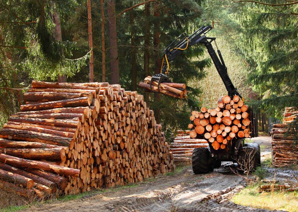
Kletr // Shutterstock
#10. Oregon
– Tree cover loss since 2010: 12.9% (1.3M hectares)
– Tree cover, 2021: 8.5M hectares
– Estimated CO2 emissions from tree cover loss: 1,132.7 metric tons
As of 2010, 10 states represented 49% of all tree cover in the United States; Oregon ranked #3 with 9.71 million hectares of tree cover, compared to the average of 5.33 million hectares per state.
Since then, though, Oregon’s ranking has tumbled. The logging industry has contributed to the loss, as have wildfires: 1.2 million Oregonian acres burned in 2012 wildfires, and over 1 million burned in 2020. Most of the 2020 damage happened during Labor Day weekend when a combination of windy weather, unusually dry fuels, and hot temperatures led to five simultaneous “megafires“—fires greater than 100,000 acres in size. Twelve other fires ranged from 112 to 50,951 acres. According to researchers, more of the Oregon Cascades burned that weekend than in the previous 36 years combined.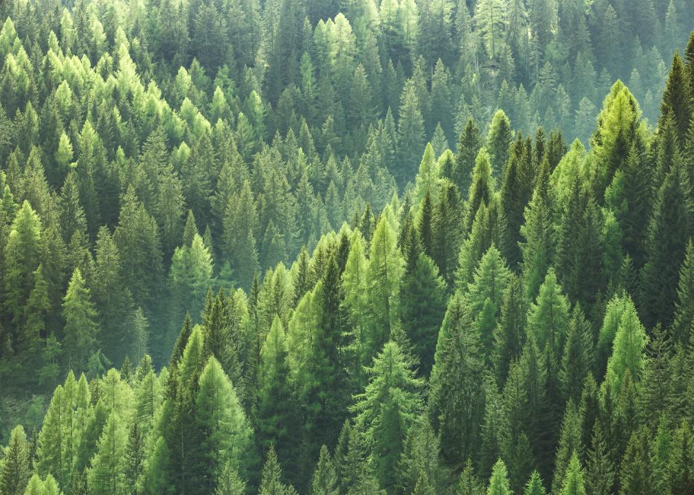
zlikovec // Shutterstock
#9. North Carolina
– Tree cover loss since 2010: 13.2% (1.0M hectares)
– Tree cover, 2021: 6.6M hectares
– Estimated CO2 emissions from tree cover loss: 478.7 metric tons
From 2013 to 2021, 66% of tree cover loss in North Carolina occurred within natural forests. The remaining third occurred on tree plantations. Overall, the loss in tree cover from 2010 to 2021 resulted in greenhouse gas emissions equal to 1.1 trillion miles driven by an average gasoline-powered passenger vehicle. Considering that North Carolina only has about 80,000 miles of roads, that’d be quite a road trip.
Lumber is a major industry for North Carolina, producing just over 5% of all domestic lumber in the U.S. Just over 70% of the lumber produced comes from softwood species, such as fir, cedar, and pine; the remainder comes from hardwood species, among them live oaks, which are prevalent in the state.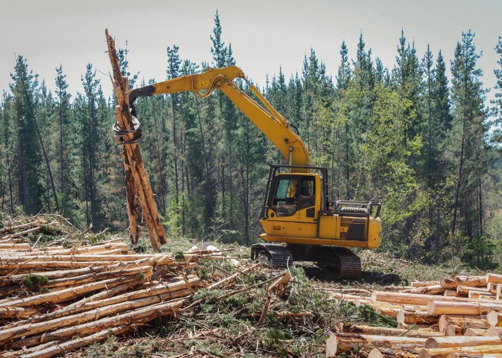
Gustavo Pereira Castro // Shutterstock
#8. Florida
– Tree cover loss since 2010: 13.6% (1.0M hectares)
– Tree cover, 2021: 6.2M hectares
– Estimated CO2 emissions from tree cover loss: 420.0 metric tons
Hurricanes have a drastic effect on Florida’s tree cover. In 2018, Hurricane Michael—among the strongest hurricanes to ever make landfall on the Florida panhandle with wind speeds exceeding 160 mph—caused widespread damage and disaster declarations in five counties. Following the storm, a Florida Department of Agriculture and Consumer Services study of 32 cities affected by Michael concluded that a combined loss of 24% of their collective tree cover—or nearly 17,000 acres—occurred.
What happens to animals who die at the zoo?
Though one may not consider a relatively humid state like Florida to be a wildfire risk, the state has experienced more than 29,000 fire alerts since January 1, 2019; fortunately, there has been no tree loss due to fire in the past 20 years.
AntonSAN // Shutterstock
#7. Louisiana
– Tree cover loss since 2010: 13.9% (0.9M hectares)
– Tree cover, 2021: 5.4M hectares
– Estimated CO2 emissions from tree cover loss: 481.5 metric tons
Half of the tree cover loss in Louisiana from 2013 to 2021 occurred within plantations. The total loss in natural forests alone was equivalent to 170 megatons of carbon dioxide emissions, the same as the emissions from burning 188 billion pounds of coal.
One culprit behind Louisiana’s 13.9% canopy loss was a tornado that tore through 60 miles of forested land in 2019, devastating 2,500 acres of pine and hardwood timber. The tornado was soon followed by Hurricanes Laura and Delta, which destroyed a combined 95,000 acres. More recently, Hurricane Ida hit the state’s timber industry to the tune of $315 million in losses due to severe damage to more than 167,000 acres of forestland across 11 parishes.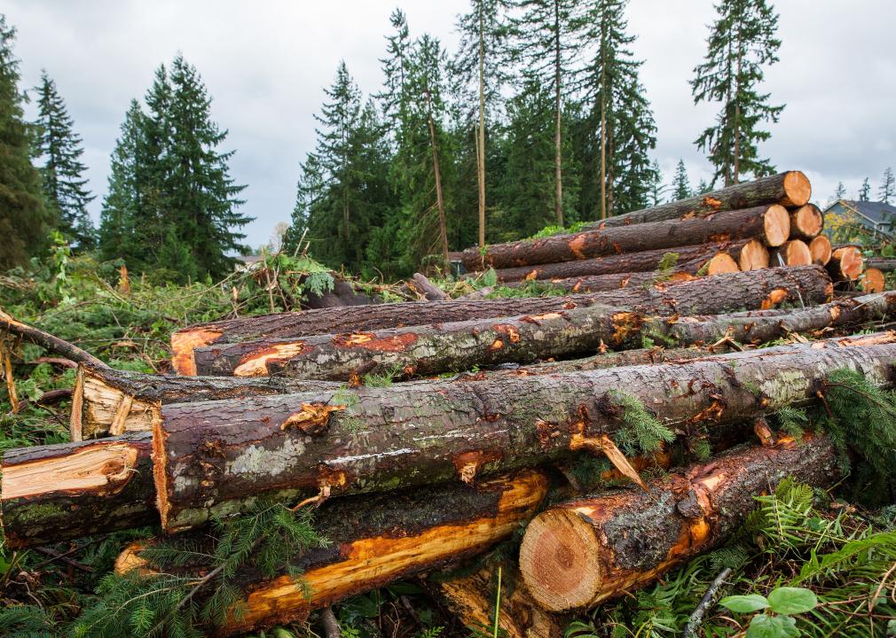
MPH Photos // Shutterstock
#6. Mississippi
– Tree cover loss since 2010: 15.9% (1.2M hectares)
– Tree cover, 2021: 6.3M hectares
– Estimated CO2 emissions from tree cover loss: 573.4 metric tons
Over 62% of all land in the state of Mississippi is forested. Mississippi’s Forestry Commission released a forestry action plan in December 2020 detailing forest land ownership: 89% is privately owned, 8.7% is federally owned, and 3% is owned by the state or local municipalities. Forestry contributes $13 billion annually to the state’s economy and employs 61,794 people. According to the commission, timber is among the three most valuable crops in any given year.
In addition to the forestry industry, contributors to the state’s loss of over 328,000 acres of forested land since 2010 include the repurposing and redevelopment of forested land for agricultural purposes, delinquencies in stewardship resulting from reduced funding, the introduction of several invasive species and non-native plants, and wildfires, which in 2021 alone claimed more than 19,000 acres.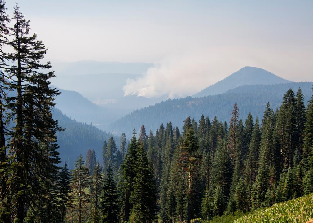
Dominic Laniewicz // Shutterstock
#5. California
– Tree cover loss since 2010: 16.7% (1.8M hectares)
– Tree cover, 2021: 8.8M hectares
– Estimated CO2 emissions from tree cover loss: 998.1 metric tons
The lion’s share (98%) of tree cover loss in California from 2013 to 2021 occurred in forests. Wildfires are prevalent in the American West, with California losing approximately 2.6 million acres of land to wildfires in 2021 alone.
Where did today’s bison come from?
The devastating effects of wildfires have also had a detrimental impact on wildlife. Animals like deer, bears, and coyotes are displaced when the forests disappear. Organizations like the International Fund for Animal Welfare have engaged with local organizations in animal rescue efforts in regions where wildfire has threatened local fauna, as in the 2021 Dixie fire, which consumed more than 960,000 acres across five counties and impacted the Plumas National Forest, Lassen National Forest, and Lassen Volcanic National Park.
Shackleford Photography // Shutterstock
#4. Alabama
– Tree cover loss since 2010: 17.7% (1.5M hectares)
– Tree cover, 2021: 7.2M hectares
– Estimated CO2 emissions from tree cover loss: 773.2 metric tons
According to the Alabama Forest Action Plan, the protection of private land from development through the donation of voluntary conservation easements has escalated in the past two decades, in part due to increased incentives for income and estate tax savings.
Most of Alabama’s forest (93%) is privately owned, and 90% of that acreage is owned by folks who want their forests to remain forests. Of those surveyed, 55% reported having little interest in selling their property. Still, the plan called out forest fragmentation—which happens when forests are parceled into smaller sizes due to change in ownership—as one of the challenges facing Alabama’s forests, along with invasive species.
Timber production is also a significant player in the state’s industry. As of 2017, the forestry industry provided more than 43,000 direct jobs, and in 2018, it added nearly 2,000 new jobs on 54 new large-scale projects off a capital investment of $1.3 billion. Alabama is the second-largest commercial timberland base in the U.S. and among the top producers of wood pulp.
The 773.2 metric tons of carbon dioxide emitted due to tree cover loss since 2010 equals the emissions from a single year’s electricity use from 150 homes.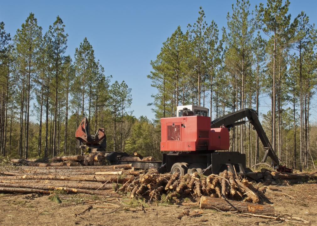
Denton Rumsey // Shutterstock
#3. South Carolina
– Tree cover loss since 2010: 18.5% (0.9M hectares)
– Tree cover, 2021: 4.1M hectares
– Estimated CO2 emissions from tree cover loss: 485.4 metric tons
South Carolina is subject to substantial development pressure. According to Furman University’s Shi Institute for Sustainable Communities, more than 1 million acres of today’s South Carolina forests will be lost by 2060 due to development, and about half of that loss will affect evergreen forests.
Global Forest Watch reports that 11 regions are responsible for 40% of the state’s tree cover loss, and the top five of those regions are located in counties situated around Charleston, a popular coastal tourist destination that also happens to be the fastest-growing city in South Carolina with multiple development projects in progress and on the books.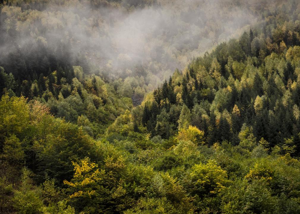
Servet Dilber // Shutterstock
#2. Georgia
– Tree cover loss since 2010: 18.8% (1.8M hectares)
– Tree cover, 2021: 7.6M hectares
– Estimated CO2 emissions from tree cover loss: 875.9 metric tons
Georgia has lost almost one-fifth of its tree cover since 2010, and more than half (54%) of tree cover loss since 2013 has occurred within natural forests. Georgia has a wildfire season, but it isn’t as severe as what states in the West endure. Georgia had just over 2,400 fires in 2021, compared to more than 8,500 in California—though this wasn’t always the case. In 2007, wildfires decimated over 564,000 acres, much of it in the Okefenokee National Wildlife Refuge. Since then, the state has taken robust action to mitigate both the conditions leading to and the damage resulting from wildfires.
Much of Georgia’s tree cover loss comes from the timber industry. Over 91% of the state’s forests are privately owned. It’s the largest timber producer in the southeastern U.S. and is home to nearly 1,400 forest products manufacturers. It’s routinely ranked on lists as one of the top pulp, paper, and lumber producers.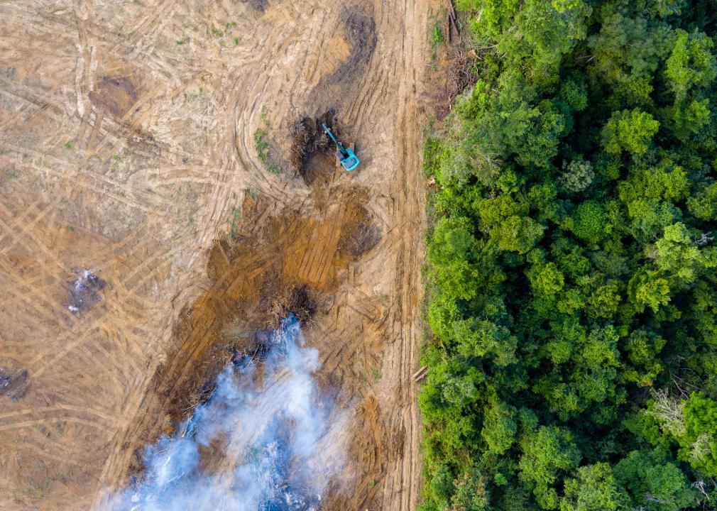
Richard Whitcombe // Shutterstock
#1. South Dakota
– Tree cover loss since 2010: 24.0% (0.1M hectares)
– Tree cover, 2021: 0.3M hectares
– Estimated CO2 emissions from tree cover loss: 36.9 metric tons
South Dakota is among the least forested states, which makes its cover loss perhaps more impactful than anywhere else in the U.S. Less than 6% of the state is forested, though the western portion is home to the Black Hills National Forest, which is protected—at least from the encroachment of man.
South Dakota forests found a foe in the mountain pine beetle, which has infected more than 400,000 acres of forest and killed millions of trees thus far in this century alone. According to the U.S. Geological Survey, this native species’ eggs are usually killed during cold winters, keeping the population down. But prolonged dry conditions in the early aughts weakened the trees and, coupled with warmer-than-normal winters, “led to a massive epidemic.” By 2017, however, brood numbers were declining and the infestation was considered over for the state as of 2019, according to a September 2022 assessment of Major Forest Insect and Disease Conditions issued by the Forest Service of the Department of Agriculture.
www.keloland.com
https://www.keloland.com/news/local-news/south-dakota-tops-list-of-states-with-the-highest-levels-of-tree-cover-loss/


